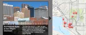
Architectural Styles in San Diego’s Urban Core, 1880-1940
Using the photographic resources of The Ned Paynter Collection, we have selected examples of both the residential and the civic and commercial architecture of San Diego’s urban core from the establishment of the new downtown through the years of the Great Depression.
The urbanization of San Diego began with the arrival of Spanish colonists in 1769. A civilian settlement grew on the river flats below the military outpost on Presidio Hill at the entrance to Mission Valley. This pueblo survived the transition to Mexican sovereignty in 1820 and the establishment of California as a United States territory in 1848. By the 1870s, Alonzo Horton’s real estate venture (the Horton’s Addition subdivision of 1867) had shifted the center of urban growth from that pueblo (which became Old Town) to a so-called New Town near San Diego Bay. The completion of a connection to the transcontinental railroad system in 1885 led to rapid population growth and a real estate boom that soon collapsed. Following the Crash of 1888, the Census of 1890 showed only 16,200 inhabitants in the city. Many of the oldest surviving buildings in the downtown area date from this time and the following decades of steady growth. By 1910 the population had grown to 39,600, and planning had begun for a fair to celebrate the completion of the Panama Canal. The Panama-California Exposition of 1915-16 in Balboa Park was especially significant in establishing the Spanish Colonial Revival style as a signature for Southern California and an influence on domestic architecture nationwide. Successive waves of construction in various architectural styles prior to World War II created a distinct regional character, a built environment of great diversity.
Civic & Commercial Architecture, 1880-1940
Historic sites designated by the City of San Diego are indicated by the HRB number; those on the National Register of Historic Places by the NRHP number. Please respect the premises of private businesses.
Residential Architecture, 1885-1930
Historical Landmarks designated by the City of San Diego are indicated by the HRB number. Please respect the privacy of the occupants of the homes.
NOTE: The Map Tours can be toggled to Full Screen, which would maximize the size of the photo display window. Complete PDF versions of the tours, including directions for following the routes, may be downloaded using the following links:
The Civic & Commercial Architecture of San Diego’s Urban Core, 1880-1940 [PDF version]
The Residential Architecture of San Diego’s Urban Core, 1885-1930 [PDF version]


